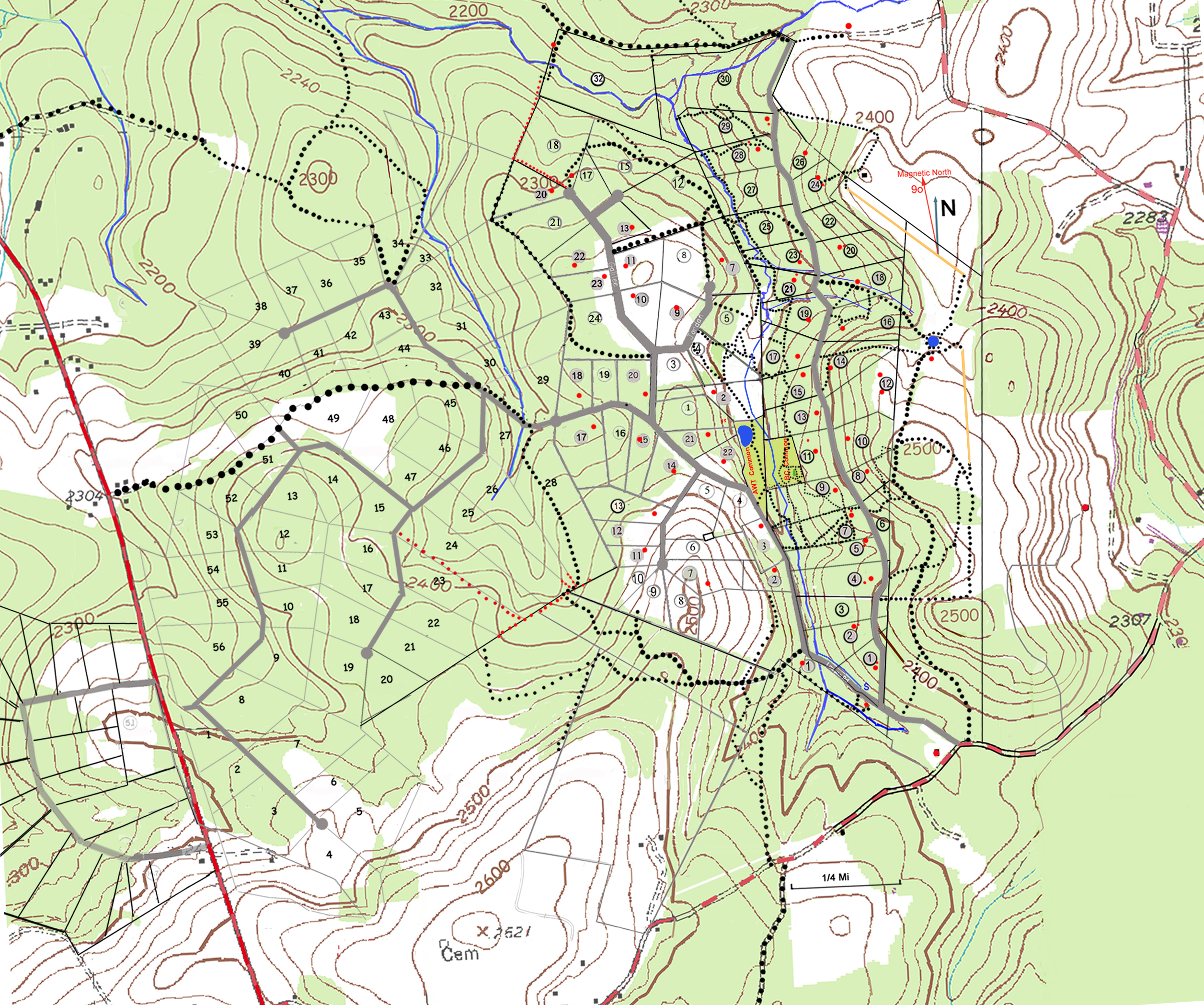
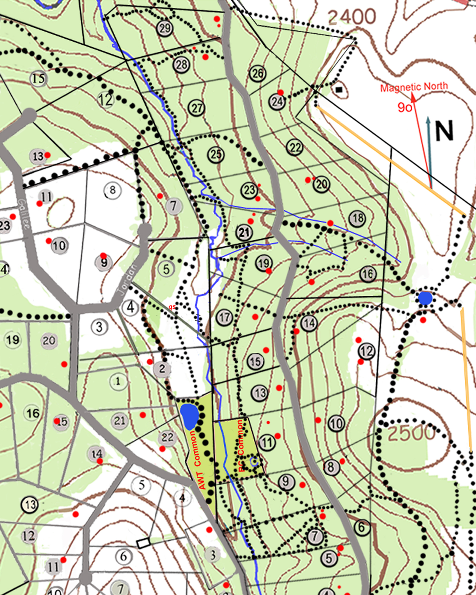
400 Acres of deep woods
Miles of trails exist in Beavercreek and Acres of Whitetail.
Hiking in most of this area is OK by association members
No Motorized Vehicles are allowed on the trails
Green area indicates woods, white is cleared area, red dots are cabins, trails are black dots.
Elevation lines and lot lines are displayed as well
Be courteous to neighbors and leave no trace
Click on the Map for a larger area view including Hazelwood and Hazelview.
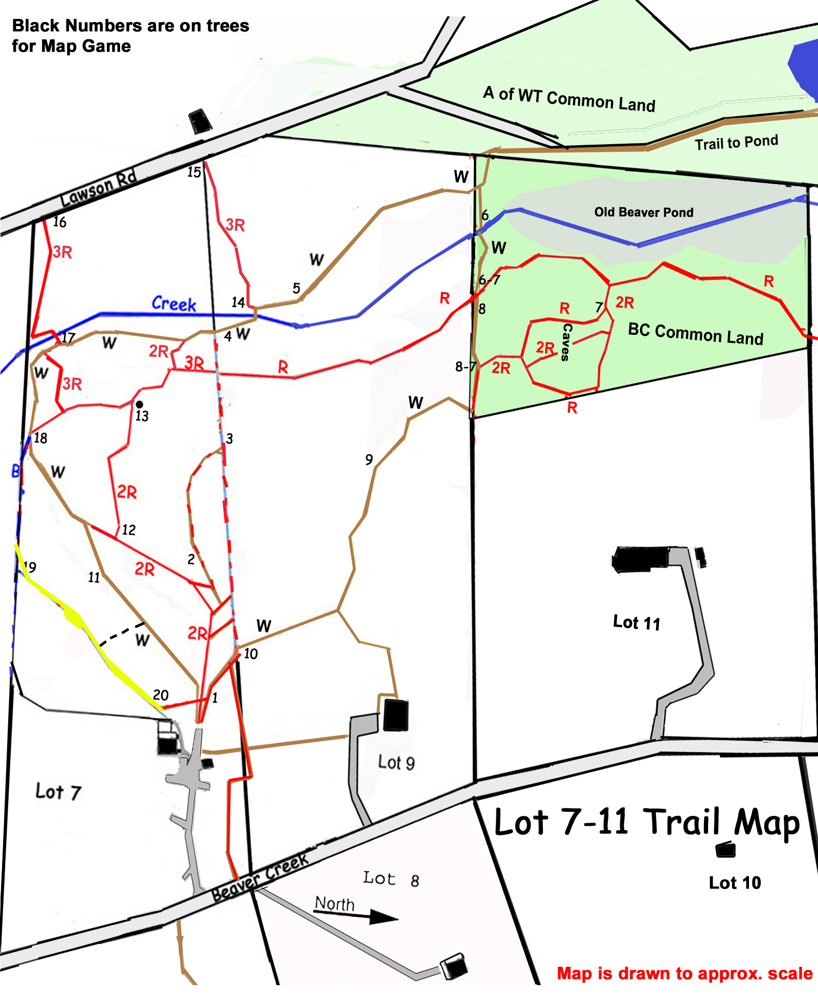
Click Here for a New 2022 Beaver Creek Common Land trail map.