Six nights at Pioneer County Park in Zolfo Springs

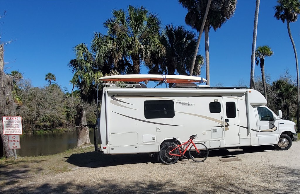
On Monday morning just as I left it began to rain, when I got off of I-75 near Sarasota to refill my Propane tank my GPS suggested I stay on these secondary roads, possibly an accident on my original route to Zolfo Springs. It was a good route and I got to Pioneer Parks by 11:30 am as the rain stopped. It’s been cool and dry since then.

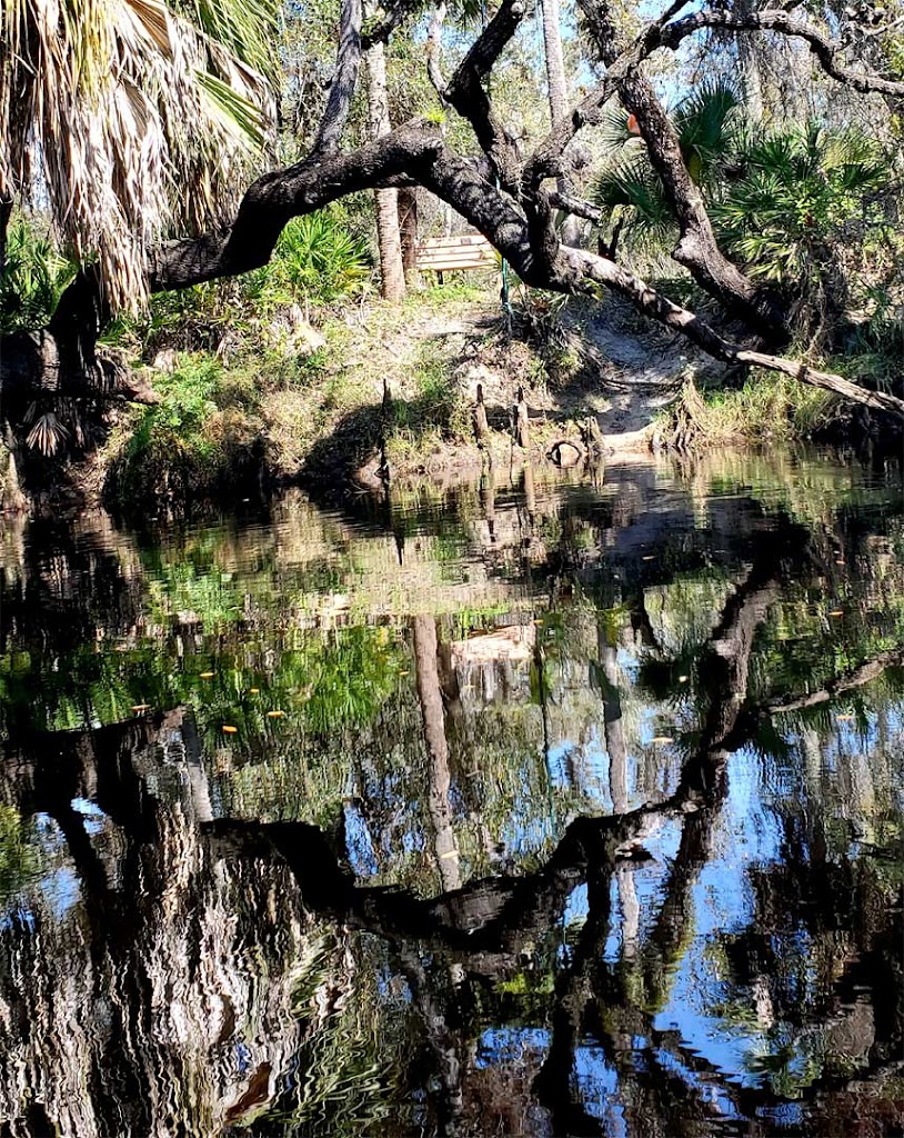
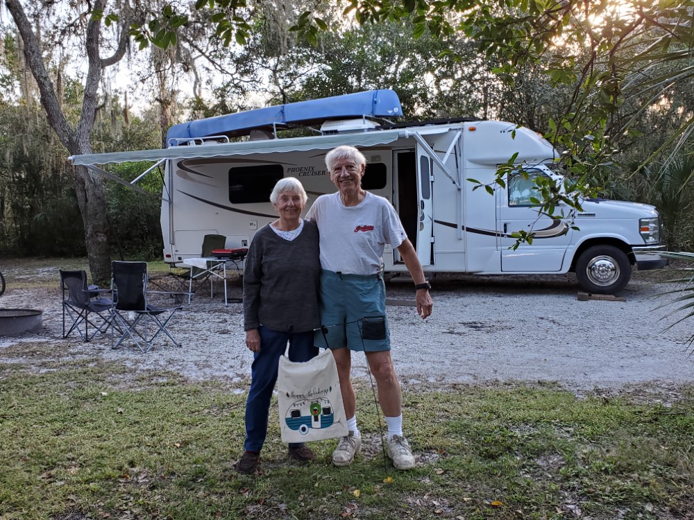
I decided to stay in the beautiful primitive campground. It has no hookups but my solar power is all I need since I picked a sunny site next to a small fishing lake, where the Ibis & Giant Egret keep me company.

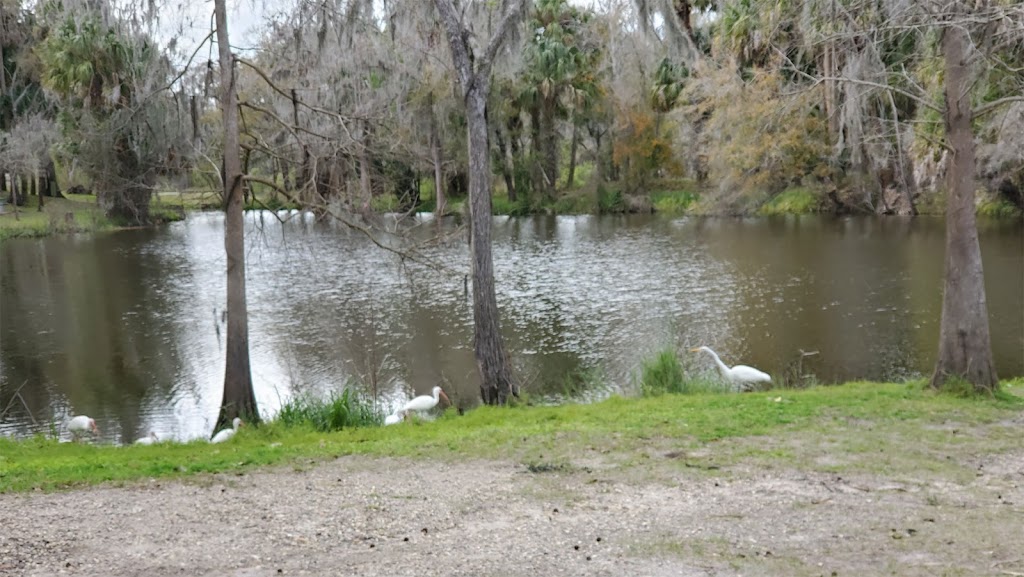
View of lake next to my campsite

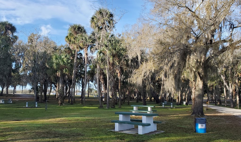
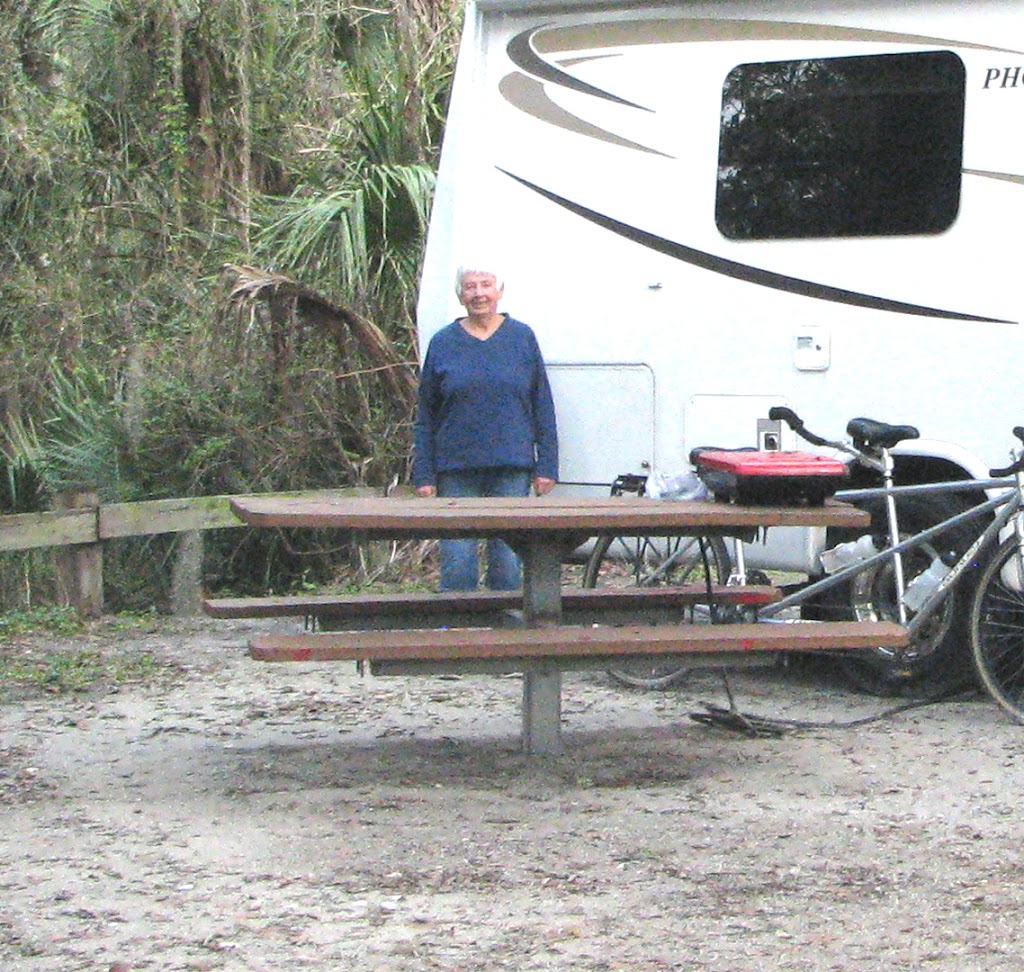
This is my view of the rest of the empty campground. Campers seem to like the sites in an open field with power & water hookups. Since it has been sunny all week my deep cycle batteries are fully charged by noon each day. I only run my generator for a few minutes if I need to use my microwave oven.

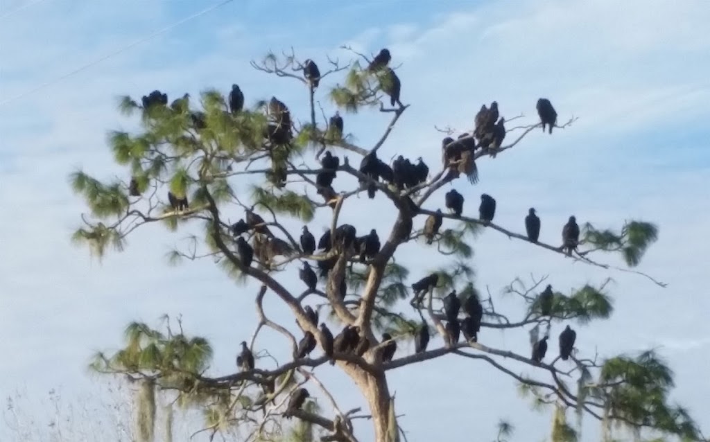
Vultures like to roost each night in the tall trees by the lake

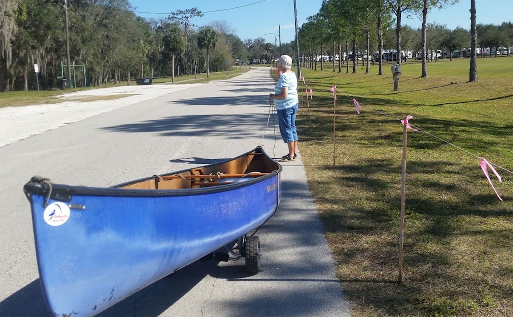
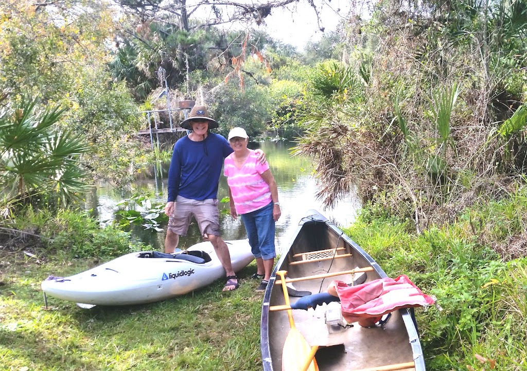
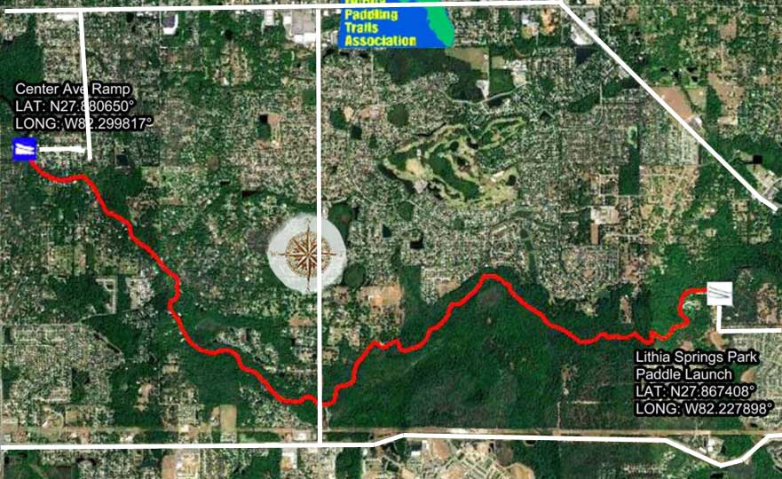
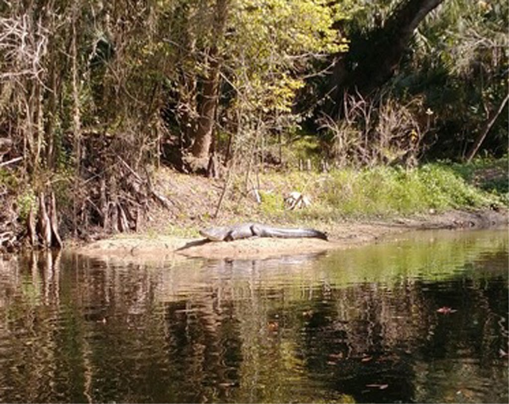
The campground boundary is the Peace River that flows from Winter Haven to Port Charlotte, FL. Peggy and I have paddled several different sections in the past. We stayed here in 2019 for 3 days and camped in the crowded camp with 50 amp power. We brought our lightweight canoe & cart with us so we could pull our canoe back from the river take-out to our campsite that you can see in the distance.

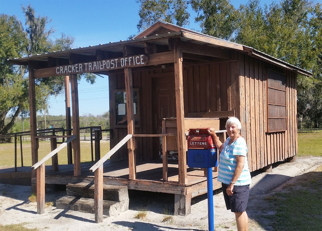
Adjacent to the campground is the Florida Cracker Museum and a series of old FL buildings. They have stories and artifacts about the original settlers in FL called Crackers. They say the name was from the crack of their buggy whips. Each year during the last few weeks in February a big festival is held here.


Zolfo Springs is very small town about 10 x 10 blocks in size with a few essential service, but just north about 5 miles is the Hardee County seat, Wauchula, FL with lots of stores and schools. I rode my bike around town and also did a 13 mile ride to a Walmart in Wauchula using a small county road, staying off the main highway US-17.

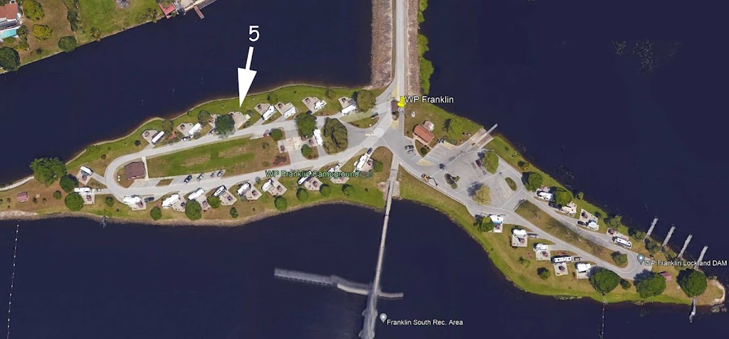
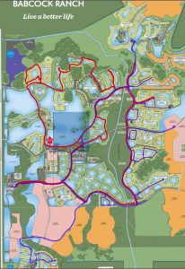
I plan to leave early on Sunday morning and bike around Babcock Ranch which is a few miles north of my destination for Superbowl Sunday, WP Franklin – Corps of Engineers campground, which is by the last lock on the Caloosahatchee River, east of Fort Myers.

Finishing my First Week at the WP Franklin COE Campground


Campsite #5 at WP Franklin
Aerial View of WP Franklin

On the way to WP Franklin on Sunday morning I stopped at the growing Babcock Ranch Development where I enjoy all the bike paths and have biked here for the past 3 years.


Click for larger map of Babcock Ranch Bike Rides 2023 (Red) & 2024 (Blue)

The eastern area is all new this year. Lots of homes but very few businesses and restaurants considering how many people now live here.

On Tuesday I paddled from my campsite up Telegraph Creek and back (7 mi) and on Wednesday I did a 13 mil bike ride through the neighborhoods near our campground.

The weather has been sunny with temps in the high 70’s all week. However they are forecasting lots of rain coming in late on Saturday and all day Sunday. So I decided Friday would be a good day to get in some more kayaking.

Hickey Creek Mitigation Area

I paddled about 1 mile up the Caloosahatchee River to Hickey Creek, and then 2-1/2 mi as far as I could make it up the creek. I had to turn around where a big fallen tree blocked my way. I checked, it was the same place I had to turn around last year. I came back to the kayak landing and had lunch, then I paddled back to my campground, a 7 mi round trip.

Here is a picture of Peggy and Bob Nicholson who paddled up here with me 7 years ago.


Now ready to start moving north

 This has been the second cloudiest winter in FL history, and one of the wettest in the dry season. We had some warm weather but only for a few days at a time.
I decided while I had the time this week I would post a map showing my entire trip including all my campspots.
The Red Numbers are my overnight stops starting in VA to FL, and are numbered from 1 to 18. The Red Lines are my actual routes. Click Here to see a larger map that can be zoomed-in.
This is my actual Trip Schedule.
I am finishing my second week at WP Franklin campground. I took some more short bike rides around the neighborhood streets.
I decided to do another kayak trip from my campsite up Telegraph Creek on Wednesday. My plan was to paddle about as far as you can go and then have lunch sitting on a bench high above the river bank in the Bob Janes Nature Preserve. But hornets in the mud banks changed my mind, so I had lunch on a river sandbar instead, and took this picture.
 
There were several very large alligators on this section of the creek. They quickly lept into the water as I wound my way up and down the tiny river. It was a 7 mile round trip.


Here is Peggy 5 years ago at the riverside campsite.

 I left at 7am on Sunday morning to try to get a campsite at Lithia Springs County Park which is about a two hour drive north of here. 

 My hope is that some weekend campers will be leaving when I arrive. I got here at 9:30AM after some food shopping, I was 4th on the waiting list. I waited and rode my bike through campground to see how many were leaving, 11am is the checkout time. I lucked out a camper was leaving a day early from one of the riverside sites and by the time he left at 11 AM the other campers ahead of me got sites so I got Site 40, a site we have stayed in twice before.

Lithia Springs County Park for 1 week

As I told in my last blog I was able to get a great campsite right on the Alafia River, #40 with easy river access. The river sites are limited to 14 days, while the rest of their campsites are available for 28 days. They do not take reservations but if you get here early in the morning, it seems someone is always checking out.


On Monday, Chris the really great campground host shuttled me and my kayak to Alderman Ford where I could put-in on the Alafia River and paddle 9 miles back to my campsite. The level was low 180 cfs but fine. It took 3 hours with a 30 minute stop for lunch.

This is a map of Upper Alafia River. Click Here to see Florida Paddling Trails Association’s River Info and bigger maps.


On Wednesday I decided I needed a haircut really bad so I biked over to Great Clips and got a crewcut.


Since I was in the western area of Fishhawk Ranch, I kept going to Bell Creek Nature Preserve and returned by Shadow Run Park, it was a nice 17 mi ride.


I’ll bet there are over 30 miles of wide concrete sidewalks that go through all their natural areas, and the trails end at Lithia Springs Campground. You seldom see any other bikers or hikers on these great trails. It does say for residents but that is not enforced.


Fish Hawk Ranch Trails – Click to view High Resolution Map

On Thursady I did another 18 mile bike ride mostly in the eastern area of Fish Hawk Trails. The weather has been perfect all week with lows around 60 and quickly warming to the mid-70’s by late afternoon.


River Launch at my campsite #40

On Friday morning I noticed that the river had dropped down to 130 CFS, which is the lowest I had ever paddled it. I like the first 3 miles of the Lower Alafia River so I decided to paddle downstream 3 miles and then back to my campsite eliminating the need to run a shuttle. There are a lot of shallow shoals and I wasn’t sure if I could paddle back upstream through all of them but I made it. It took me almost 30 min longer going back upstream to my camp. It took a little over 2 hours with no breaks.

This is a map of the 7 mile Lower Alafia River. Click Here to see Florida Paddling Trails Association’s River Info and bigger maps. 

I saw 3 nice sized gators enjoying the sunny skies. Most jumped in the water when I approached.


Peggy’s last time at Lithia Springs

On Sunday I will head north about 60 miles back to Cypress Glen Campground in the Withlachoochee State Forest. It’s been 2-1/2 months since I was here on my way south. My travels must not have been far since this is the first time I had to get gas since then.

Back to Cypress Glen for one week


I left early Sunday morning to head north to Cypress Glen Campground. I got to my campsite-48 at 11:30am. 

My plan was to take the Good Neighbor Bike Trail to Brooksville on Monday. It’s normally a nice 26 mile flat rail-trail ride, but right before town the trail was blocked and I was detoured to the road, no bike lane and a big hill. I tried a different route back around the detour but it was still hilly. It added a about a mile to my bike ride.

I checked the river level and was surprised that the low water in December (50 cfs) caused by the Fall drought was gone and the winter rains brought the level way up to 240 cfs. It was the wettest winter ever.

I decided on Tuesday I  would see how far up the Little Withlacoochee River I could paddle. After about a mile I eventually got blocked by a tree across the narrow river, so went back and then up the main river to Crooked River Park. I scared an alligator who then scared me by jumping into the river next to my kayak.

On Wednesday my daughter Joan and my grandson Jake flew in to paddle with me on Thursday at Weeki Wachee Springs. They got a motel room nearby and picked me up. No car rack so I couldn’t take my kayak. We rented a single and a tandem and got an early start so it was not crowded when we paddled up the river from Rogers Park about 2-1/2 miles. We hoped to see some Manatees but no luck, they didn’t need to come upstream to the warm spring water.

 
We all loved the crystal clear water, and it was sure easier going back downstream with the current. We ran into dozens of paddlers now comimg up the river, I’m glad we got an early start. 


Jake takes a break on a small sandbar.
Here we are back at my campsite, it was a fun visit but they had to head back to Tampa for a party with Brian’s mother to celebrate Joan’s and her birthdays.
 

Joan brought me some birthday gifts including this Biking Jersey.

 
I wore it with my biking shorts on Friday for my 32 mi roundtrip ride to Floral City. I set a personal record of an average speed of 12.8 mph,  one mph faster than when I did the same ride in December. Must have been the jersey.


Picture of Peggy in March 2021 on Weeki Wachee Springs River
 

I was able to leave by 7:30 AM on Sunday morning for a sunny 3 hour drive to Ocean Pond National Forest Campground between Jacksonville and Lake City, off I-10. They don’t take reservations but even though it is now Spring Break time, I found 3 open sites in the camp with 120v power, but those sites all had the power broken so they were only charging the same as the non-power sites, $10/night, I grabbed a favorite site #11 and saw that the camper behind me was using the 50 amp power plug in his site, so I asked him if I could run a long 30 amp cord to his unused 30 amp plug. He said fine, that’s what he did last week when he was in #11 and then moved to #6 when it became available. I was in site #6 for 10 days last November. Both these sites are large and nobody is around you. I noticed there were a dozen empty water-only sites available when I arrived.

Here is a Link to my Blog when I was here in November.

After 1/3 of a year my Winter RV Trip has ended and I’m back home

Friends Along the way (click on picture to enlarge)

I left home on 11/11/23 and just got back home on 3/14/24, 124 nites on the road. Things went smoothly and I did a lot on biking-850 miles and 120 miles of kayaking .

 I visited with many friends along the way. You can read about the trip in Chronological Order, Click link Florida Trip 2023-24
 

When I got to my last campground, Ocean Pond, the previous day’s heavy rain made some of the sandy roads that I ride on a little soft but I was still able to bike another 28 miles in two rides around the Lake and through the Olustee Civil War Battlefield.

I like to stop at Ocean Pond before heading for home so that I can pick two sunny days to drive home. The travel window this year was a little tight but as long as I could get an early start and make good time I could beat the storms that were coming to Ohio on late Thursday.

I got a 7 am start both days and only lost about 20 minutes going through Charlotte, so my first day’s 560 mile trip took me 10-1/2 hours and I got to Wytheville, VA. 


On Thursday I made the 390 mile trip home in 6-1/2 hours. It was sunny and no rain but two hours after I got back there were thunderstorms and tornadoes in central Ohio. 
 

Friday was warm to I could wash the winter grime off my RV and got a good start unpacking, especially when my daughter Joan stopped by to help.


Of course it now looks like the next 3 weeks here will be cooler than normal. No complaints, it was a nice winter and I was able to do all the things I planned and got in a lot of Cardiac Rehab again. 

 
I enjoyed all the nice campgrounds and for the entire trip the average camping cost per night was less than $18.


Most of all we all missed Peggy


Tentative Plans for 2024-25 Winter Trip

I have a tentative plan for my 2024-25 RV trip to Florida. I made reservations at the places I could and hope to be able to get a campsite in the campgrounds that do not take reservations by getting to most of them early on a Sunday morning. I do not drag a car so anyone that wants to share a campsite with me that has a car or van camper, I’m sure I can fit you on my campsite. Tents are also OK but no RV’s. Only one per site. I will update this schedule as I go along.

Click for Tentative 2024-25 Trip Plan You may download and print this PDF file.

Galax and the New River Trail

 I decided to leave a day early because of the heavy rain forecast for Cleveland on Sunday. That turned out a good choice since Saturday was sunny & cool. Since I was planning to visit my friends Greg and Sandy
Lewis in SC on Monday I had an extra day and that worked out well also. I did the same thing I did last year. Overnighted at a Lowes in Galax, VA, it was very quiet and had good Wi-Fi. A mile down the road there is a great Mexican restaurant and had the same Mexican stir fry as last year. 

Chestnut Creek Falls

The New River Trail starts in Galax and follows the beautiful little Chestnut Creek for 10 miles down to the New River and then  40 miles along the New.

Trail Tunnel

Last year they were replacing 3 bridges so you couldn’t take the trail downstream along the New River. You could only go upstream 5 miles to the town of Fries.

Both Directions Closed

There were no signs of hurricane of flood damage along Chestnut Creek so I was hoping to go downstream 2-1/2 mi to Byllesby Dam.

It turned out both directions were blocked since the hurricane’s big flood took out parts of the upstream trail. The downstream trail totally washed out hundreds of tons of gravel destroying the trail that they had repaired last year. It may be finished next year a worker told me. 


Conflunce of New & Creek

I decided to drive a few hours to Forest City, NC so I would only have 2 more hours to drive in the morning. My GPS decided to give me a shortcut that I knew would be interesting when I saw a sign that said no semi-trucks. It was a five mile long narrow switchback road down the mountain to I-77. Luckily only a few cars were coming up hill. 

The when I was on I-40 my GPS said road to Forest City was closed and was trying to take me a much longer route to Asheville. This time I ignored it since I wanted to stay overnight in another Lowes parking lot. There were no closed roads but hundreds of fallen trees along the road from the hurricane.
 

At Greg’s beautiful home in Sunset, SC

I left at 8 am on Monday morning, the overnight rain had ended, from Forest City, it was on;y a 2 hour drive to Greg & Sandy’s home in Sunset, SC. It turned out Greg had just got back from a tennis tournament in Memphis, TN and Sandy was in CA for a funeral. I plan to be here 3 days visitng and biking,

Greg Lewis is a long time paddling buddy originally from the Cleveland area that I have known for almost 50 years. He and his wife Sandy built this beautioful home in the mountains above Lake Keowee almost 15 years ago. 

Peggy and and I have often visited them when they were home and did some hiking and biking with them in the area.. 

They would visit us at our cabin in WV and Greg & I spent many days paddling the Upper Yough. We biked with Sandy on the GAP Trail along the Casselman River.

When we first bought our Tandem Bike, Peggy, Greg and I headed over to Pickens, SC to peddle the Doodle Trail, an 8 mile long paved trail that goes to Easley, SC.


It was cool on Monday but Tuesday was a sunny 75oday.

So on Tuesday Greg and I decided to do the Doodle Trail. I had forgotten all the small hills. Our 16 mile ride had over 800 feet of elevation changes to traverse. It was a good workout. We decided to have a late lnnch at a nearby Mexican restaurant and skip dinner. On Monday Greg had cooked me a great fish dinner.

Greg is painting the inside of his garage this week so when they come to do a colorful chip floor he doesn’t get paint on it. I’m trying to catch up on all my e-mails and plan to leave on Thursday.

I was going to do the Doodle Trail on on my way to Greenville, SC, but the weather forcast is for a rainy Thursday, so on Friday I will do the Swamp Rabbit Trail that I also did last year. The weather is supposed to warm again to the mid-70’s.

I heard parts of the trail may still be closed from Hurricane Helene. I think I’ll stay at a Walmart in Traveler’s Rest and start at the North end of the trail and see how far south toward Greenville I can go until I need to turn around.